DURATION: 01.01.14 to 30.04.2018
BUDGET: 454,702.40/ 6,489,268.92€
FUNDING: FP7 Collaborative Project, Coasts at threat in Europe: tsunamis and climate-related risks
ABOUT PEARL
PEARL: Preparing for extreme and rare events in Coastal Regions, was a 4 year FP7 Collaborative research project funded by European Union’s Seventh Framework Programme for Research, Technological Development and Demonstration (EU-FP7) and aimed to develop adaptive risk management strategies for coastal communities against extreme hydro-meteorological events, minimising social, economic and environmental impacts and increase the resilience of Coastal Regions in Europe. The PEARL consortium consisted of 24 partners from 13 countries from Europe and Asia, with significant experiences of severe flood risk in coastal regions and advanced flood early warning systems.
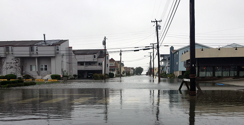
Coastal floods are regarded as one of the most dangerous and harmful of all natural disasters. Rapid urbanisation in coastal areas combined with climate change and poor governance can lead to a significant increase in the risk of local pluvial flooding coinciding with high water levels in rivers and high tide or storm surges from the sea, posing a greater risk of devastation in coastal communities. There is a need to improve forecasting, prediction and early warning capabilities using state of art science and technology to help policy makers and emergency services to develop robust risk reduction strategies. However, forecasting and prediction is only part of the answer. Of equal importance is the ability to effectively warn the population in areas that will be affected, and that warning systems for the general public are integrated into broader management strategies and supported by appropriate institutional and organizational arrangements. Preparing for effective response to extreme events not only involves technology but also significantly social, economic, organizational and political considerations.
The PEARL project’s primary aim was to fill in the lack of interaction between social aspects and technical measures – appearing to be a major hindrance for solving some of the greatest problems associated with floods and flood-related disasters.
Based on the belief that problems are best solved by attempting to correct or eliminate root causes, as opposed to merely addressing the immediately obvious symptoms, the PEARL project aimed at developing adaptive risk management strategies for coastal communities focusing on extreme hydro-meteorological events, with a multidisciplinary approach integrating social, environmental and technical research and innovation. PEARL considered all fundamentals in the risk governance cycle, focusing on the enhancement of forecasting, prediction and early warning capabilities and the building of resilience and reduction of risk through learning from experience and the avoidance of past mistakes. Read more about project’s objectives and outcomes here
The pilot case study in Rethymno
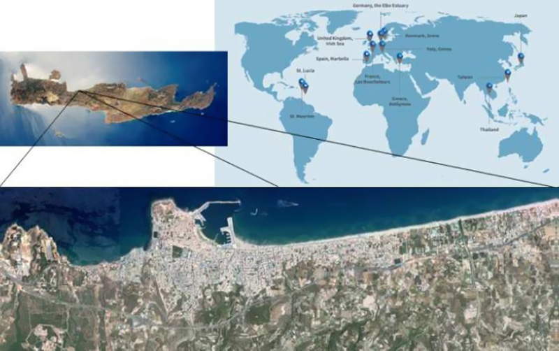
The project examined six case studies from across Europe and five case studies from the Caribbean and Asia. One of the EU case studies was city of Rethymno in Crete.
Flooding has always been a serious problem for Rethymno causing an ongoing threat to its residents, homes, businesses and public infrastructure. Major flood events have been encountered throughout the years, resulting in serious damages mainly in the Old Town of Rethymno and the east low-laying areas. Rethymno is located in the drainage basin of the north part of Vrysinas mountain making stormwater flow through the urban area inevitable.
In addition, the coastal zone of Rethymno is exposed throughout the years to strong N and NW winds (7-Bf) with great fetches, resulting in the development of great waves. Changes in wind conditions had resulted in causing storm events more frequently than in the past. More specifically extreme weather conditions with strong winds resulted in the creation of storm waves combines sometimes with flash floods form ephemeral streams.
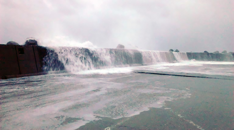
Owing to the large quantity of stormwater that drains through the streams of Rethymno city, flooding is considered to be one of the natural hazards. Additionally, extreme waves result in violent wave overtopping that occurs along the windward breakwaters of the harbour and threats the stability of breakwaters as well as the safety of human population. Huge quantities of seawater as well as the wider coastal area cause interruption in loading and unloading operations, damage the port facilities, disturb traffic and affect the coastal economic activity (shops, restaurants, etc.). Additionally, the adjacent to the harbour recreational beaches are exposed to erosion.
The goal for Rethymno case study was to develop a specific actionable roadmap for flood risk management through a Decision Support System (DSS), in collaboration with local stakeholders. The work included a comprehensive analysis for holistic and multiple risk assessment. The establishment of Learning Action Alliance (LAA) distinguished the involved stakeholders. Exploitation of the multi-scale, integrated modelling framework (WP2) produced downscaled precomputed scenarios for Rethymno in order to address multiple potential hazards. The socio-economic dimension was incorporated through comprising models such as behavior simulation, agent’s algorithm, and urban growth scenarios with cellular automata. Hydrological models, mainly precipitation-runoff models, when used with real time data, forecasts or even hypothetical hydrometeorological data, enabled the DSS to become a real-time flood warning system. Research within PEARL provided feedback for enhancement of existing infrastructure and operational strategies against the danger of flood by helping stakeholders to identify areas that are sensitive to floods and also to define efficient flood management strategies, engineering, environmental and socio-economic measures for Rethymno case study.
OUR ROLE IN THE PROJECT
UWMH participated in the PEARL project in multiple activities with a starring role in the project and the lead of work related to the decision support and policy development for strengthening the resilience of coastal regions. Our team brought on board the frontrunner Rethymno case study, where multiple research activities were conducted on the identification and understanding of flood risk under different scenarios, the assessment of resilience, equipping the authorities with tools for decision making and developing actionable roadmaps.
The tools we developed:
- An intelligent Knowledge Base for supporting selection of resilience strategies against extreme hydro-meteorological events in coastal regions by:
a) giving access to a tool which assesses the vulnerability of a city to floods and
b) by creating a repository of knowledge on types of floods, resilience measures and case studies around the world where the measures have been applied. - A toolbox to enable interested parties to discover methods and tools supporting selection of resilience strategies. We also supported the activities on developing the PEARL online collaborative learning and planning platform (e.g., tool’s integration, uploading content of flood hazard maps, etc.). Within the significant outcomes of our team was a state-of-the-art agent-based modelling tool for the exploration of decision-making processes in flood risk management.

- Decision support and policy development for strengthening resilience of coastal regions: UWMH led the methodology for decision support and policy development by designing and application of the Learning and Action Allicances framework in Rethymno. The LAA framework was applied in 5 case study areas while UWMH was in charge for Rethymno LAA, where we conducted several workshops with local stakeholders who were identified by a thorough stakeholder analysis and mapping relevant to flood risk management.
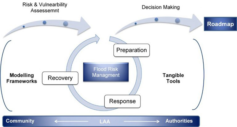
UWMH put significant effort in the case study work and flood modelling in urban, rural and coastal environment by:
- collecting data,
- supporting activities for the understanding the formation of vulnerability and risks (i.e. application of the Risk and Root Cause Assessment framework, support the conduction of household survey and conduct spatial vulnerability assessment),
- deploying state-of-the-art modeling suites (DHI models, XBEACH, Eurotop, etc.) and approaches for the simulation of physical processes from the origins of river catchments to the coastal zones. Additionally, we worked on tasks to achieve faster simulations for flood forecasting purposes and early warning systems by minimizing computational loads and increasing computation speeds. Under different scenarios (e.g., historic precipitation events, dam break, etc.) flood maps were created, and flood hazard and risk assessment were conducted. Based on coastal simulations, existing infrastructures at the harbour area were assessed and new solutions were suggested.
- Through the stakeholders’ engagement (LLAs, interactive activities, discussion, focus groups, etc.) an actionable roadmap was developed for the city of Rethymno to assist food management and decision making processes.


